Laleston
A Village Full of HistoryLaleston
Stones Trail
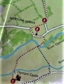
The Laleston Stones trail begins at the romantic site of
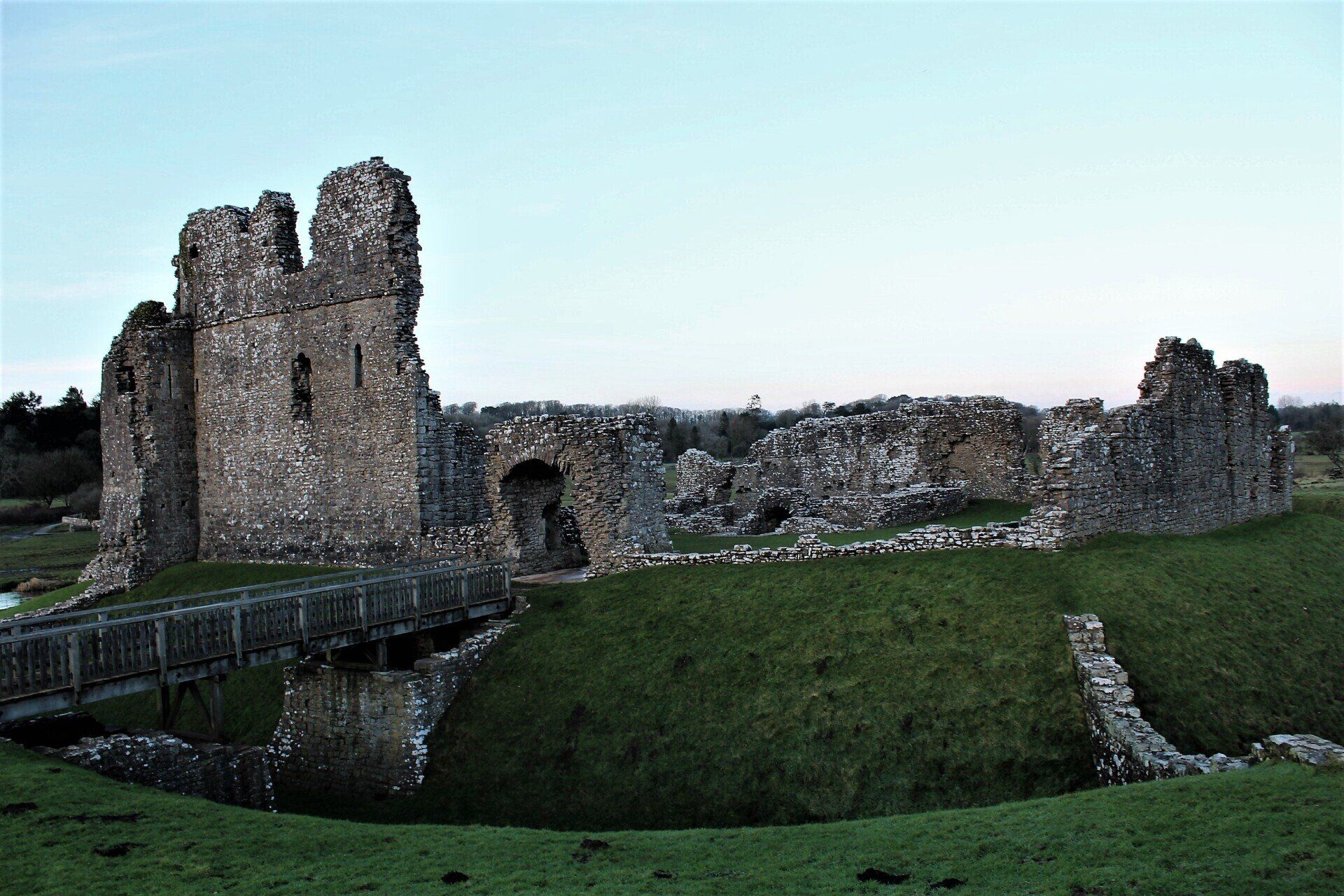
Ogmore Castle, now a ruin. Built by the lords of Ogmore as a military stronghold to defend the frontier against the wild Welsh over the river, you can still see the massively fortified Twelfth century tower, the gatehouse and the footings for the drawbridge, the thirteenth century hall and the large moat structure.
Cross the river by the stepping stones and follow the Coast Path over a footbridge to Merthyr mawr.
Click the Picture to view more pictures and read further information about the history of Ogmore Castle.
From Ogmore Castle you can take either of two routs, over the stepping stones and follow the trail to the footbridge over the river Ogmore.
Or go back up to the road and turn left and cross the Ewenny river bridge and follow the trail to the river Ogmore and cross the footbridge, follow the trail to the road, turn left to St Tiloe's church.
Leaving the Church, turn right, after a few yards there is an old stone stile on you right which is the trail (Waymarked Bridgend Circular Walk) the walk will take you through a small wooded area behind the church.
Cross a stile and continue on the same path with the hedge to your left and cross a stone stile to the lane. Ahead of you are the stone buildings of the Home Farm.
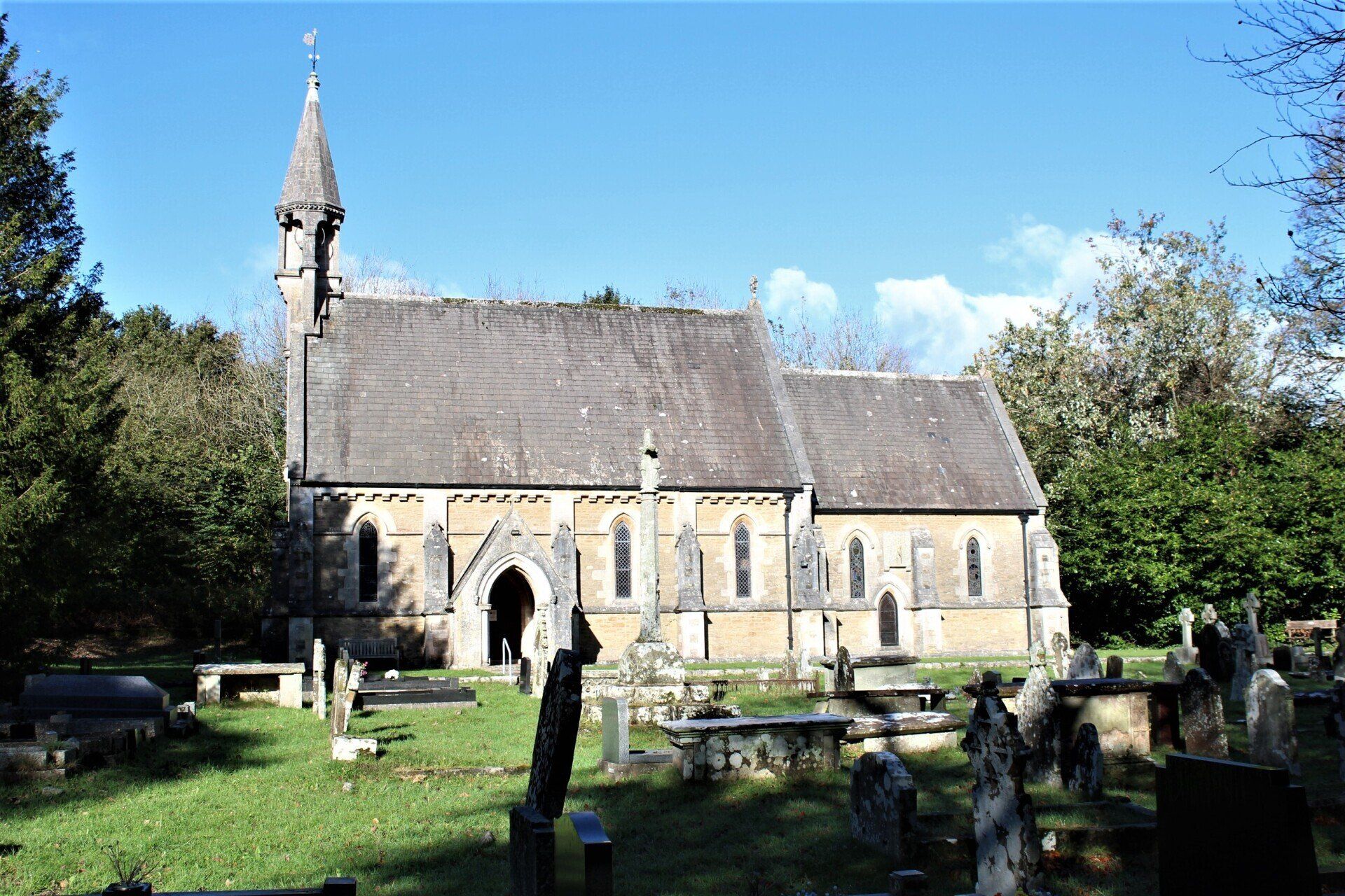
Merthyr Mawr translates as Great Martyr and could refer to the possible burial place of the Welsh saint Myfor. This picturesque village is well worth exploring with it's thatched cottages and larger farmhouses.
The Victorian church with its quaint spire, which replaced a bigger medieval building, the foundations of which are still visible in the churchyard, there are also the remains of the churchyard cross, which gives evidence that this was once an important place in the middle ages.
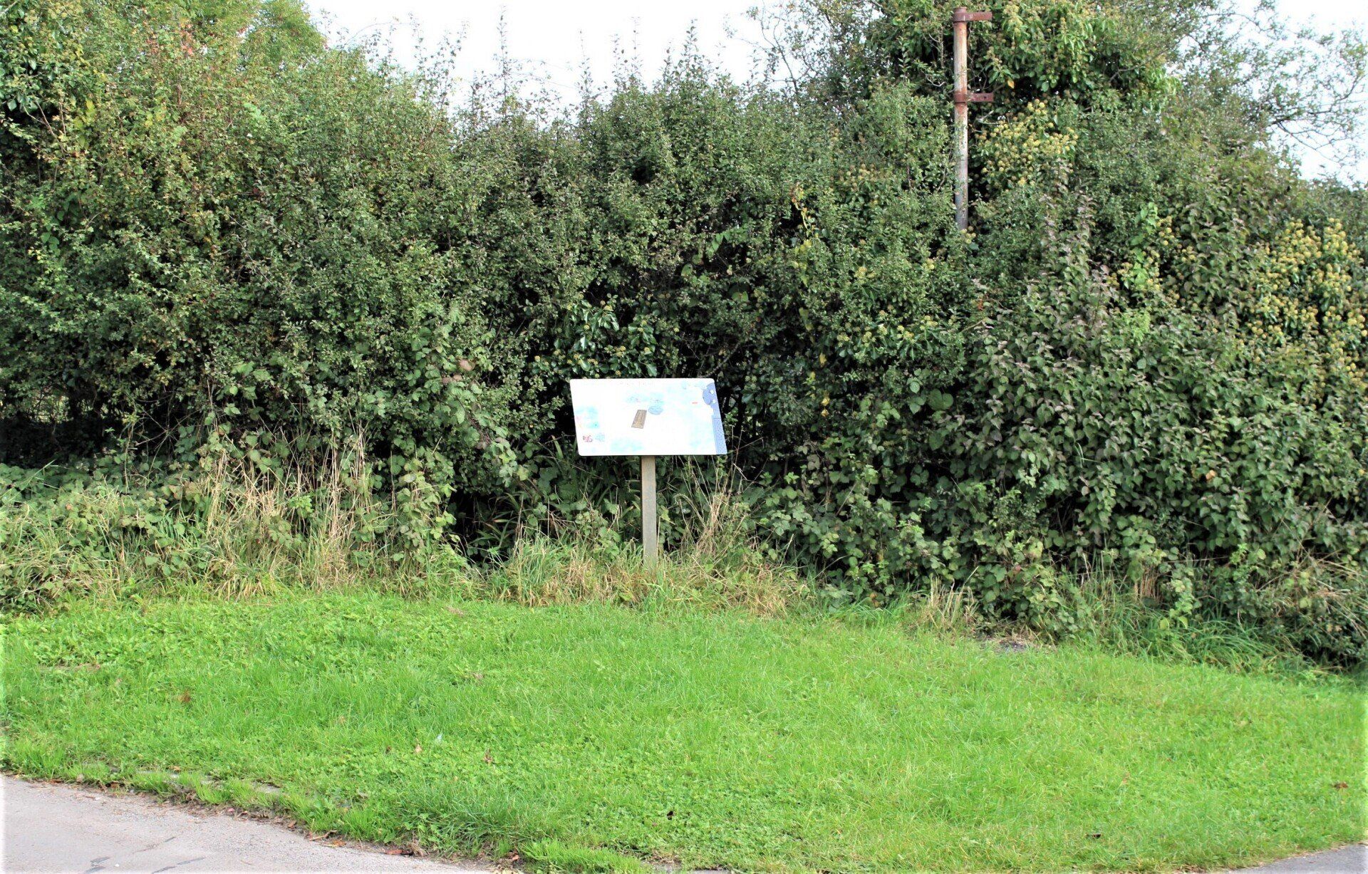
Behind the church there is a collection of early carved 'Celtic' crosses and some intriguing medieval gravestones, an interpretation board is on the wall at the back of the shelter.
Turn left, and walk up the hill, to your right is an early nineteenth century mansion Merthyr Mawr House partly hidden by a stone wall.
Continue on along the lane until you reach the A48 and continue on the other side untill you reach the cross roads on the outskirts of Laleston village.
Or you can follow the old route the pilgrims took by following the doted line on the map across the fields to the A48, turn right and follow the road before crossing into the field opposite follow the track into Laleston village turn left will take you to St Davids Church.
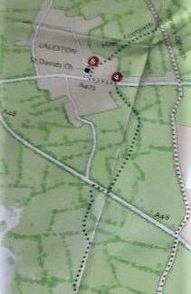
You are now at the cross roads in Laleston at a point where you can see a map of the trail and the sunken base of a pilgrims marker post that once stood at this point.
Also in the 1800's until the early 1900's a wooden stocks stood on this site, a means of punishment to those who broke the rules.
You can now continue your journey along the lane to the standing stones of St Cewydd's Church.
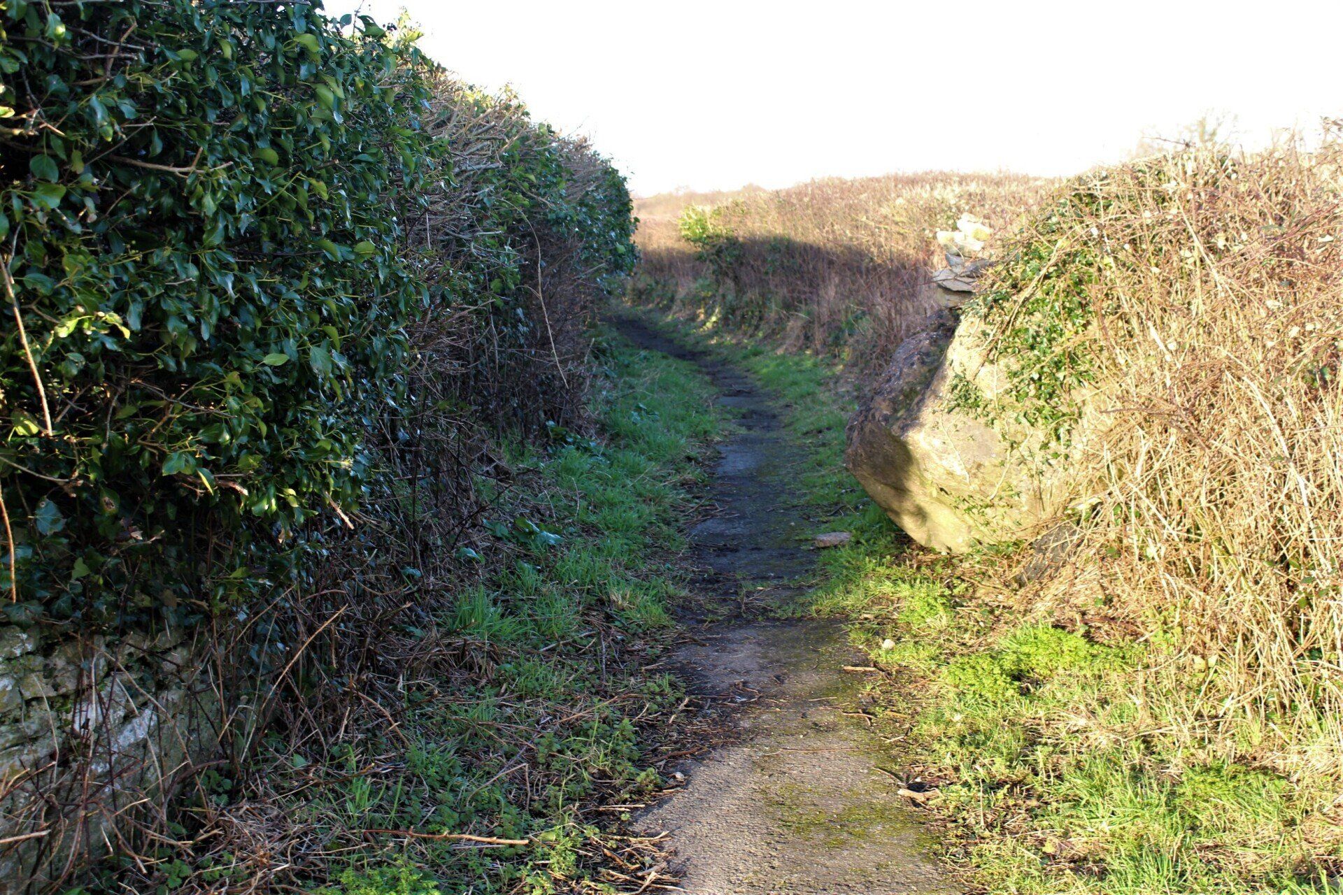
But along the way you will pass an ancient cart track to your right, this narrow track curves around and opens out giving field access through gates on either side before, continuing on to join the Llangewydd lane at the S bend which if turning left will also take you to the Standing stones and the Pound further on.
The cart track becomes overgrown at times and becomes impassable.
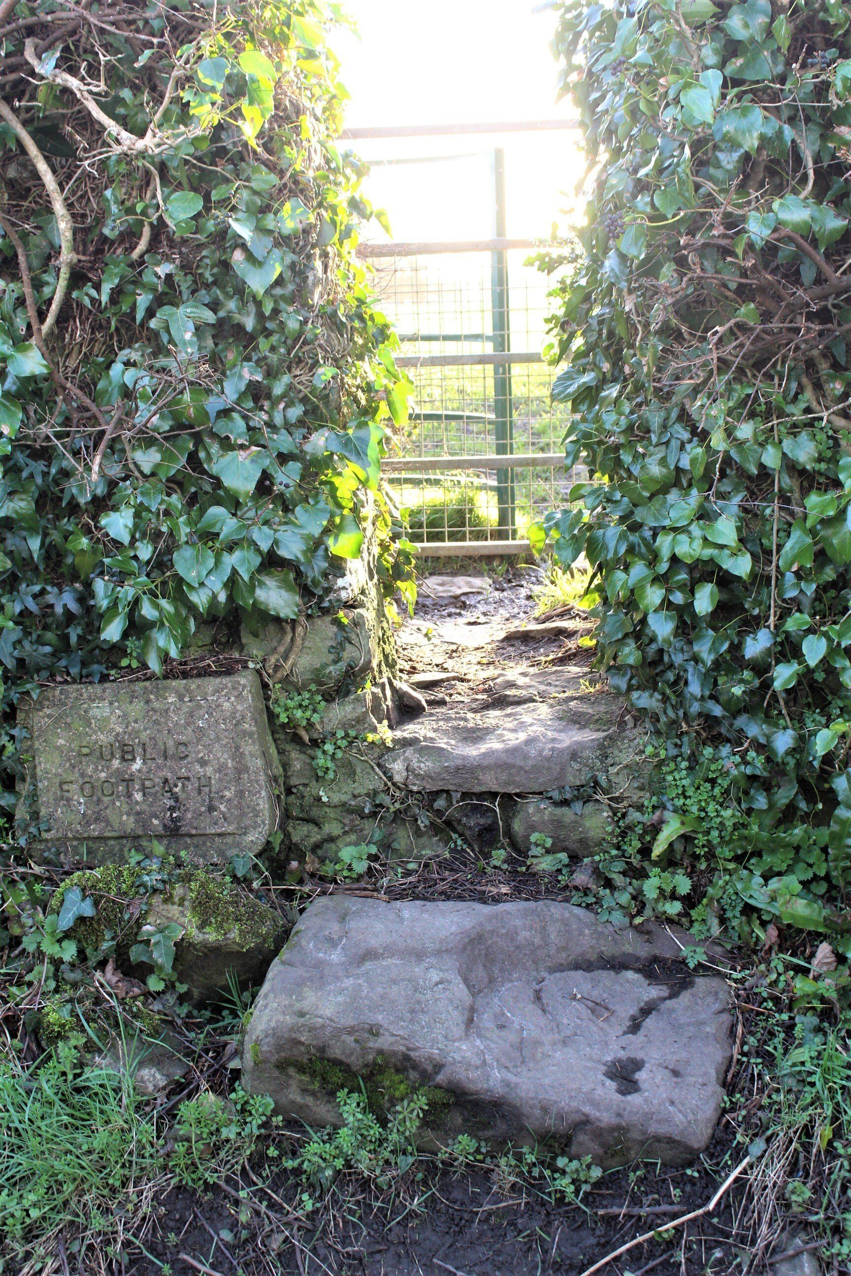
Continue your journey about 50 meters further along from the entrance to the Cart track and you will see a concrete sign to your left. "Public Footpath" and a narrow opening with slabbed steps to a gateway partly hidden by the hedgerow, this is where the pilgrims track across the fields from St Davids church emerges.
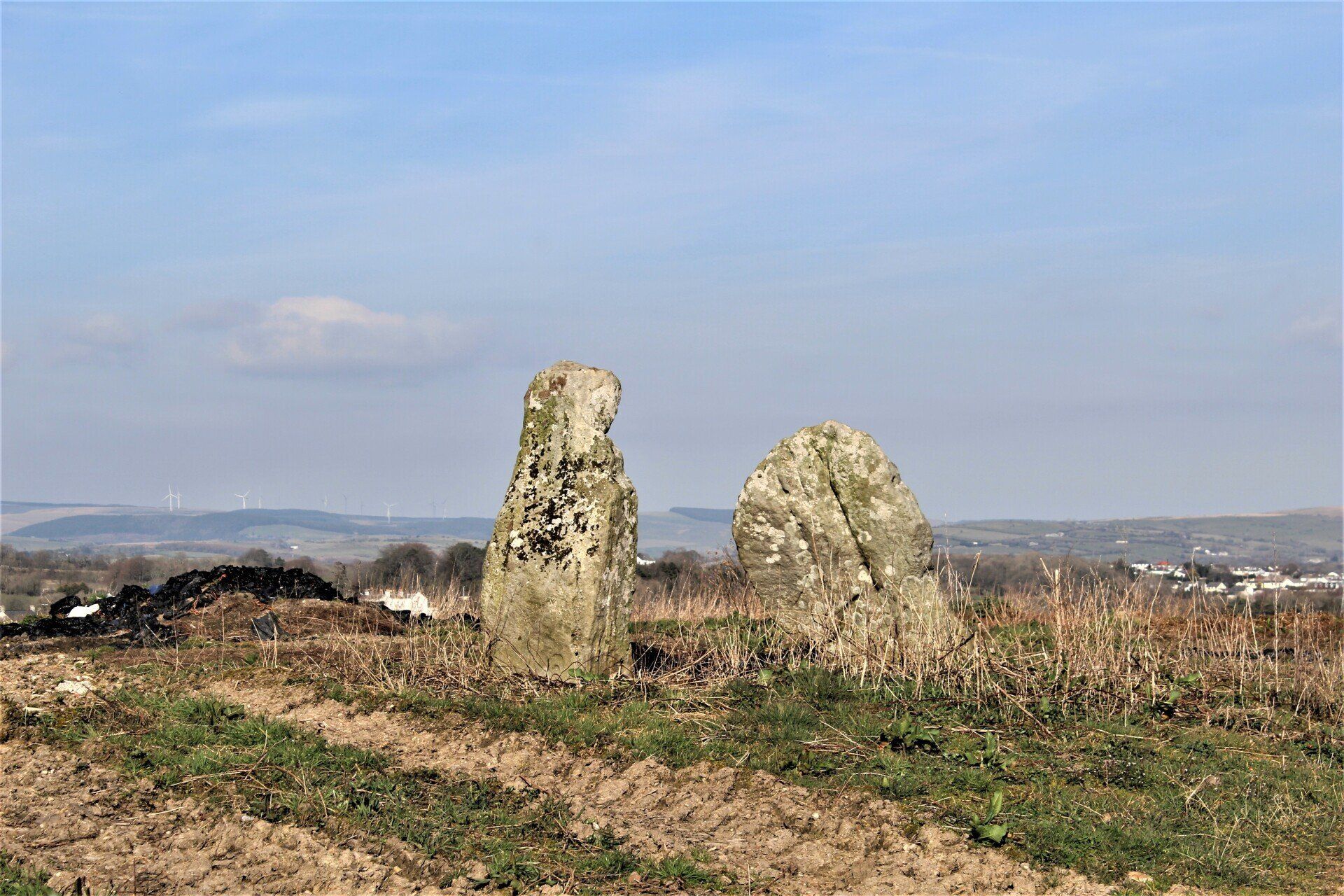
Pressing on from here for about half a mile and you will arrive at the Standing Stones of the medieval church of St Cewydd.
The standing stones are thought to be the remains of the entrance to the Medieval 11th century church yard of St Cewydd's Church. The two stones are all that remains of the medieval church and village. Two carved ‘Celtic’ crosses were recovered from the area and are now on show at the National Museum of Wales.
There are a few plain standing stones in the hedge to the left of the two in the picture and many piles of stones from the buildings around the fields perimeter. There is no public access to the field as the land is now farmed. Scheduled Ancient Monuments (SAMs) have statutory protection.
Travel further down the lane to your left and you will arrive at a stone structure called the Pound.
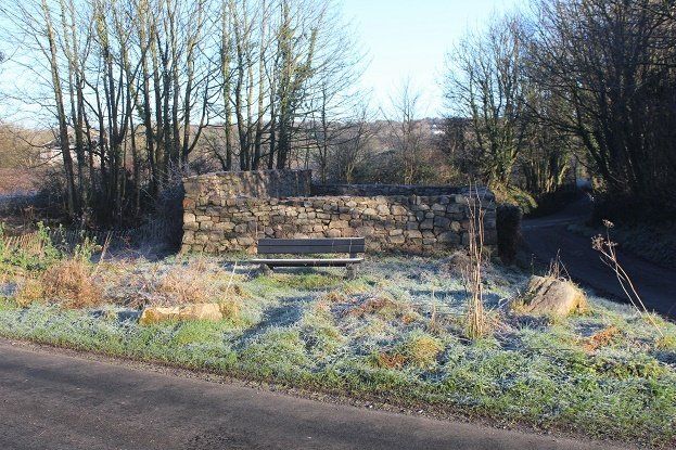
The Old Pound on a crisp Spring morning
The Old Pound is situated on a junction on Llangewydd road in Laleston, Bridgend. 51o 31’07.76”N 3o 37’39.67”W
Constructed of stone in the shape of a rectangle and situated on a mound to a height from its base to approx 2m at the front and 2.5m at the rear with a single entry gate of steal to the front. It measures 10.5m by 7m approx.
The present building is thought to be from the late medieval to early modern period, but there was probably an animal pound there considerably earlier built of less sustainable materials, which would have had to be re-built numerous times.
Continue on and across the road, the field before you once held the village of Llangewydd but no signs of it now remain.
Moving on past the ancient pound to the fields beyond where the lost village of Llangewydd once stood.